Papakōlea: One of A Handful of Green Sand Beaches on Earth
There are only a handful of green sand beaches on Earth. One is in Norway. One is on Guam. One is in the Galápagos Islands. And one is on the Big Island of Hawaii, hidden in a bay cut into an ancient cinder cone near the southern tip of the island — the southernmost point of all 50 U.S. states.
Papakōlea Beach gets its color from olivine — a dense, semi-precious volcanic mineral that Hawaiian tradition calls the "Hawaiian diamond." The beach is set within Puʻu Mahana, an eroded cinder cone that erupted roughly 50,000 years ago. As ocean waves eat away at the cone's walls, olivine crystals weather out of the volcanic rock. Because olivine is significantly denser than the other volcanic particles mixed with it, the surf sorts the material: lighter ash and basalt grains are carried out to sea, and the heavy olivine accumulates on the beach. The result is sand that is 88 to 92 percent olivine crystals by weight — and visibly, unmistakably green.
The Geology: What Makes a Green Sand Beach
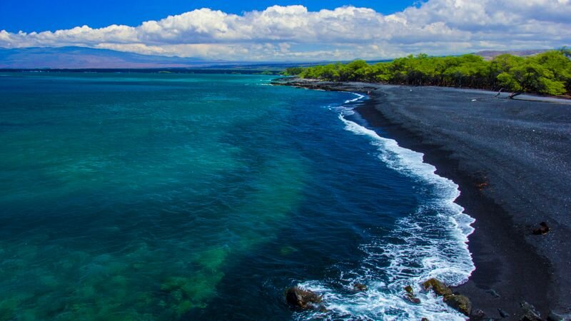
Most sand on Earth is quartz — the mineral left behind after eons of weathering of granite. Hawaiian beaches are different because there's no granite; the islands are entirely volcanic. Hawaiian black sand beaches get their color from rapidly cooled basalt lava. The white beaches are primarily coral and shell. And Papakōlea gets its green from olivine — a magnesium-iron silicate mineral that forms early in the crystallization of basaltic magma and is abundant in the Big Island's lava.
Olivine is chemically stable and mechanically hard. It doesn't dissolve easily in seawater and doesn't break down to fine powder as quickly as the glassy volcanic ash it's mixed with. This stability, combined with its density (roughly 3.3 grams per cubic centimeter, compared to about 2.65 for quartz), is what allows it to concentrate on the beach while lighter material disperses. The wave energy acts as a continuous sorting machine, running every day for thousands of years.
The green is not uniform across the beach. Mixed in with the olivine are black lava grains and traces of white coral and shell. Some patches of the beach look brilliantly green; others appear more olive or brownish depending on the light, the tide, and the exact mixture. The most vivid green is visible on dry sand on a bright day, when the olivine crystals catch direct sunlight.
Ka Lae: The Southernmost Point of the United States
Papakōlea sits in the Kaʻū district, about 3 miles from Ka Lae — South Point — the southernmost tip of the 50 U.S. states. Ka Lae is a windswept rocky headland with almost nothing on it: a small boat ramp, a scattering of mooring rings cut into the lava by ancient Hawaiian fishermen (still visible), and an offshore area with some of the best fishing in Hawaii. The wind at South Point is nearly constant and can be brutal — this corner of the Big Island sits in the direct path of the trade winds with no obstruction for thousands of miles of open Pacific.
Ka Lae was also among the earliest landing sites for Polynesian voyagers arriving in Hawaii. The ancient mooring rings in the lava — holes drilled to tie off canoes against the wind and current — are a reminder that people have used this austere point for a very long time. You can look south from Ka Lae and know that the nearest landmass in that direction is Antarctica.
The Hike: No Shortcut, No Shade
You cannot drive to Papakōlea. From the South Point parking lot (at the end of South Point Road, off Highway 11), the beach is 2.5 miles each way over a rough, rocky, exposed dirt track. There is no shade. The wind can be fierce. There are no facilities at the beach — no water, no restrooms, no services of any kind.
The walk is not technically difficult — it's fairly flat — but the exposure makes it demanding. Heat, sun, and wind are the challenges. Wear sturdy footwear (the path is rocky), bring at least a liter of water per person, apply sunscreen thoroughly, and start early in the day before the sun is directly overhead.
Local residents sometimes offer truck rides from the parking area to within half a mile of the beach. These vehicles operate on Hawaiian Home Lands where the road is legally closed to private vehicles. Using these rides supports the local community and is common practice, but it is technically unauthorized. Most visitors hike.
Leave it intact: It is illegal to take sand from any Hawaii beach — and especially from Papakōlea, where each grain of green olivine represents millions of years of geology slowly concentrated in one place. The beach is eroding slowly as waves remove material faster than Puʻu Mahana weathers new olivine. Don't accelerate that process. Leave the green sand on the beach.
Swimming at Papakōlea
The beach is beautiful but swimming is not always safe. The cove is partially protected by the walls of the cinder cone, but ocean swells and shore break can be strong. There are no lifeguards. On calm days in summer, the water inside the cove can be swimmable; on days with any swell, it can be dangerous. Read the water carefully before entering. The green sand is spectacular from the beach even if you don't swim.
Explore the Big Island
From South Point and the green sand beach to Kīlauea, manta rays, and Mauna Kea — the Big Island is unlike any other Hawaiian island. Compare tours and adventures.
Browse Big Island Tours →Frequently Asked Questions
Why is Papakōlea Beach green?
The green color comes from olivine — a dense, semi-precious volcanic crystal that concentrates on the beach because it is too heavy for waves to carry away. It erodes from the walls of Puʻu Mahana, an ancient cinder cone surrounding the beach. The sand is 88–92% olivine crystals by weight.
How do I get to Papakōlea Green Sand Beach?
A 2.5-mile hike each way from the South Point parking area. Fully exposed, no shade, extremely windy. Bring plenty of water and sunscreen. No facilities at the beach. Locals sometimes offer paid truck rides from the lot — common practice but technically unauthorized. Round trip typically takes 2–3 hours.
Is Papakōlea the southernmost beach in the US?
It's very close — it's located near Ka Lae (South Point), which is the southernmost point of all 50 U.S. states. Both Papakōlea and Ka Lae are in the Ka'ū district of the Big Island, the southernmost geography in the United States.