Waimea Canyon: Why Kauai's "Grand Canyon of the Pacific" Surprises Everyone
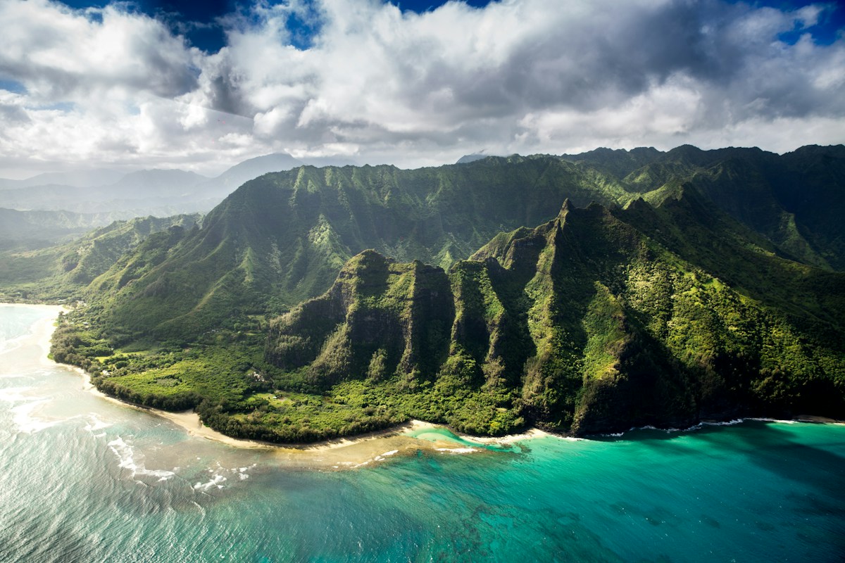
Kauai is called the Garden Isle — and most visitors picture beaches, waterfalls, and jungle. They don't picture a canyon. But on the dry western side of the island, past the sugarcane fields and the small town of Waimea, a road climbs away from the coast through increasingly dramatic terrain and arrives at a viewpoint where, suddenly, you are standing at the edge of a gash in the earth roughly 14 miles long, a mile wide, and over 3,600 feet deep.
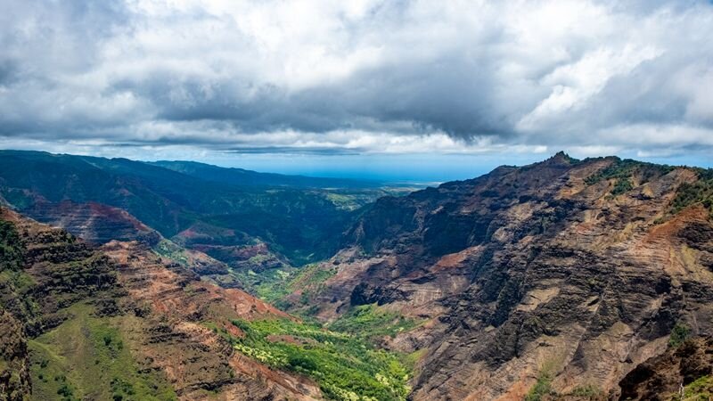
Waimea Canyon is the largest canyon in the Pacific Ocean basin. The canyon walls are striped in red, brown, rust, and green — iron-rich basalt oxidized by millions of years of weather, punctuated by streaks of bright green vegetation clinging to ledges and waterfalls tumbling down the side. On clear days from the main overlooks, the canyon reveals itself in layers of depth that take a moment to resolve. It looks bigger than you expect. It looks like it doesn't belong in Hawaii. And then it starts to make sense.
How Waimea Canyon Formed
Kauai is the oldest of the main Hawaiian Islands, formed roughly 5 to 6 million years ago. When the island's massive shield volcano began to collapse along an internal fault line, a large depression formed on the western side of the island. The rain pouring off Mount Waialeale — which sits at the center of the island and receives roughly 450 inches of rain annually, making it one of the wettest places on Earth — channeled through the Waimea River and began cutting into this depression.
Over millions of years, the river and its tributaries eroded the depression into the canyon you see today. The dramatic red color of the walls comes from iron oxide — essentially rust — in the basalt. The same iron that makes the Arizona Grand Canyon red is responsible for the color here: oxidized iron in the volcanic rock, exposed by erosion. The green vegetation growing on the ledges and walls contrasts with the red in a way that is distinctively Kauai — even the canyon looks like the Garden Isle.
The Grand Canyon Comparison
Waimea Canyon is reliably called the "Grand Canyon of the Pacific." The comparison is useful and a bit misleading. The real Grand Canyon in Arizona is about 277 miles long and over 6,000 feet deep at its deepest — far larger than Waimea. But Kauai is a small island roughly 25 miles across. By that measure, Waimea Canyon is extraordinary: a canyon a mile wide and over 3,600 feet deep in the middle of a 562-square-mile island in the Pacific Ocean.
The nickname "Grand Canyon of the Pacific" is often attributed to Mark Twain, but this appears to be a myth — Twain never visited Kauai. The attribution is generally traced to American explorer John Wesley Powell, who visited in 1869. Regardless of its origin, the comparison holds enough truth to have stuck for well over a century.
The Lookouts and What You See
Waimea Canyon Drive (Highway 550) climbs from the town of Waimea on the coast to the canyon rim and beyond, eventually reaching the Koke'e area and Kalalau Lookout at around 4,000 feet elevation. The drive is about 26 miles round trip from the coast and climbs through dramatic terrain changes.
The main Waimea Canyon Lookout is at mile marker 10, roughly 3,400 feet elevation. This is the most dramatic viewpoint — the canyon opens below you in its full width, with red walls dropping to the Waimea River far below and waterfalls visible on the far walls. The Pu'u Hinahina Lookout, a few miles further up the road, offers a different angle and on clear days a view of Ni'ihau island (the "Forbidden Island") on the horizon.
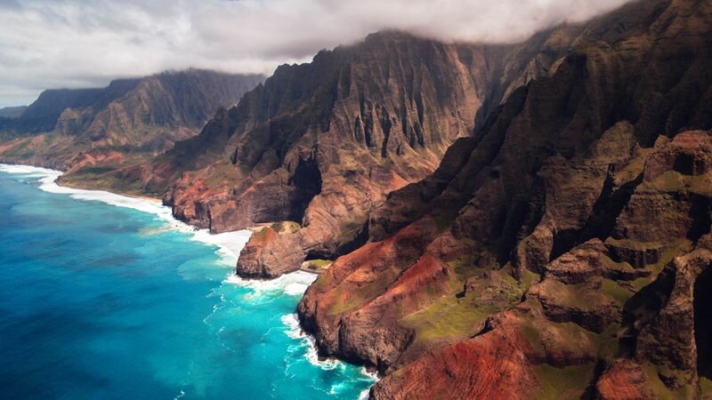
Beyond the canyon, the road continues into Koke'e State Park, where the Kalalau Lookout provides an entirely different experience: a 4,000-foot view down into the Kalalau Valley on the Nā Pali Coast, with the Pacific beyond. Combining Waimea Canyon and Kalalau Lookout in a single day trip gives you both the interior and coastal extremes of what Kauai's geology produced.
Visibility tip: The canyon is often in cloud or mist, especially in the afternoon when clouds build inland. Morning visits — arriving at the lookout by 9 or 10 a.m. — give the best chance of clear views into the canyon depths. The upper reaches near Kalalau Lookout are frequently clouded even when the lower canyon is clear.
Hiking in the Canyon
Waimea Canyon State Park offers several hiking trails ranging from short rim walks to multi-day backcountry routes descending into the canyon floor. The Canyon Trail (3.4 miles round trip from the Pu'u Hinahina Lookout) descends to the base of the 800-foot Waipoʻo Falls — one of the most striking destinations in the park. The Kukui Trail descends steeply to the Waimea River at the canyon bottom and is considered one of the most challenging trails on Kauai.
For those who want to see the canyon without a strenuous hike, helicopter tours often fly through the canyon and along the adjacent Nā Pali cliffs — giving an aerial perspective that integrates both Kauai's interior and coastal geology in a single flight.
Explore All of Kauai
From Waimea Canyon to the Nā Pali Coast and Hanalei Bay — compare Kauai tours and activities with live availability.
Browse Kauai Tours →Frequently Asked Questions
How big is Waimea Canyon?
Approximately 14 miles long, about 1 mile wide, and over 3,600 feet deep. It is the largest canyon in the Pacific Ocean basin — the scale is genuinely surprising on an island the size of Kauai.
How was Waimea Canyon formed?
Through a combination of volcanic collapse and millions of years of erosion by the Waimea River, which carries rainfall from Mount Waialeale — one of the wettest places on Earth. The red color of the walls comes from iron oxide in the oxidized basalt.
Did Mark Twain call Waimea Canyon the Grand Canyon of the Pacific?
No — this is a persistent myth. Mark Twain never visited Kauai. The nickname is generally attributed to explorer John Wesley Powell, who visited in 1869.